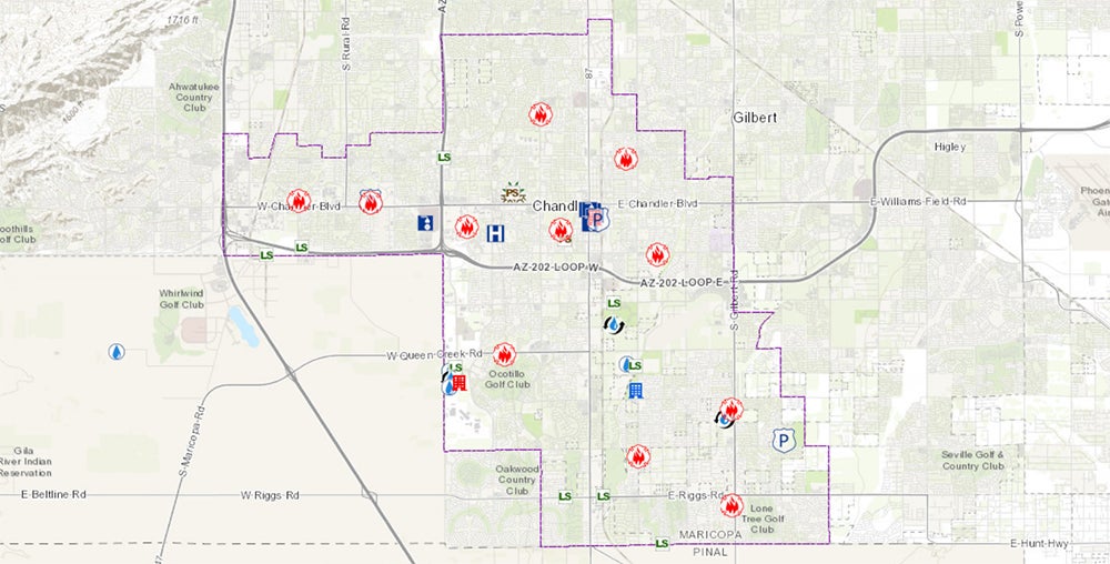
InfoMap is an interactive map that links to information about existing or planned facilities the City believes may be of particular interest to the public.
The map shows where various facilities are located, plus information about the facility, along with a phone number and web link to obtain additional information if desired.
The map has a legend that lists the various facility types displayed on the map. Each type has a specific symbol. As you zoom into the map, additional layers of information appear and their corresponding symbol shows up in the legend. Clicking on a symbol, such as the Municipal Building symbol, activates a pop-up window with the address, phone number, website and description of the facility.
A Basemap Selector allows users to change from a line map to an aerial map and a Search tool helps locate addresses and facilities. A Near Me widget allows users to type in an address to find out what facilities are located near that address.
The Neighborhoods widget is especially useful, as it shows the location of neighborhoods registered with the City, of which there are over 300, and clicking on the neighborhood opens a pop-up window showing the number of homes, establishment date, contact information and links to maps of the neighborhood that can be printed. Users not finding their neighborhood on InfoMap can contact Chandler's Neighborhood Programs Office at 480-782-4300 to get registered.
Road restriction information also appears on the map as red, green or blue lines, depending on the severity of the traffic restriction. Clicking on the location opens a pop-up window describing the restriction and expected duration. There also is a layer that indicates which streets are privately owned. This data layer appears as users zoom into the map and disappear when zooming out.


