The ability to go places for work and leisure is essential to the Chandler lifestyle. Building upon established mobility systems provided by three major highways, a well-planned arterial street network, public transit and a growing airport, we expanded transportation options in 2022 and integrated new technologies to efficiently get people where they want to go.
Expanded Transportation Services

Expanded and renewed pilot programs for micro transit services through the launch of Chandler Flex and the first-mile, last-mile program with Lyft to offer transit options in areas underserved by existing service.

Awarded $1.25 million in grants to upgrade the traffic signal video detection system across Chandler to more efficiently detect vehicles and bicyclists at intersections.

Completed road expansion projects on Alma School, Chandler Heights, Cooper, Gilbert and Ocotillo roads to improve mobility in portions of south Chandler.
 Improvements")
Americans with Disability Act (ADA) Improvements
Reconstructed curb ramps and sidewalks on Washington St., Boston St. and Chicago St. to bring this downtown area up to current ADA standards.
Completed ADA improvements at the ASU Chandler Innovation Center, Chandler Airport, Chandler Museum, Chandler Nature Center and the Sunset Branch of the Chandler Public Library.
Initiated ADA improvements at Tumbleweed Park, Pima Park and Sunset Park.
Bike Lane Projects
Completed new bike lane projects, connecting points of interest and fixing system gaps.

McClintock Drive and Kyrene Road Bike Lanes
Narrowed medians to add bike lanes on Kyrene Rd from Chandler Blvd north to Orchid Lane and on McClintock Drive from the Loop 202 north to the City border with Tempe.

Chandler Boulevard Bike Lanes
Added bike lanes on Chandler Boulevard from I-10 to 56th Street.
Bike and Pedestrian Studies
Initiated studies to improve bicycle and pedestrian connections for people traveling to
employment, entertainment, neighborhoods and recreation locations.
Frye Road Protected Bike Lanes
Construct a physical barrier to separate bikes from vehicle traffic on Frye Rd. between the Paseo Trail (west of Cooper Rd.) to a half-mile west of Arizona Ave. Work on this project is slated to begin in 2023
Western Canal Crossing at Union Pacific Railroad
Bicycle and pedestrian improvements to the railroad crossing along the Western Canal.
Connecting Ashley and Paseo Trails
This project will complete the connection between the Ashley Trail and Paseo Trail by adding a safe crossing of Cooper Road, approximately 1/2 mile north of Chandler Blvd and a 400 foot path east of Cooper Rd. to complete the connection.
Price/Ocotillo Shared Use Path
This study provides 15% design plans for a shared-use path on Ocotillo Road from Dobson Road to 148th Street and protected bike lanes on Price Road from Ocotillo Road to the Loop 202
Hunt Highway Traffic Calming and Protected Bike Lane Study
This study will provide 15% design plans for a shared use path/separated bike lane and potentially make recommendations for traffic calming on Hunt Highway from Cooper Road to Val Vista Drive.
Canal Shared Use Paths
Completed studies for the Kyrene Branch Canal and Highline Canal Shared Use Path projects.
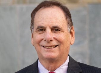
Taking Flight at Chandler Municipal Airport
Directly from the Source: Season 1, Episode 3
The Chandler Municipal Airport is among the nation’s busiest general aviation airports in the country. Listen in as host Matt Burdick and Airport Manager Ryan Reeves discuss what’s involved with managing the airport, its role in the nation’s aviation system and future development plans.