

GIS, which stands for geographic information systems, is an important tool for delivering residents all kinds of location-based news — including traffic restrictions, crime activity, zoning cases, public art and so much more. If you've ever used our online interactive maps, you’ve experienced GIS technology at work in our city.
GIS Day is celebration nationwide by GIS professionals on Nov. 15. Chandler’s GIS team works with multiple city departments to help sort data and offer solutions to make key information available to the public. Check out some of the top 10 uses of GIS below.
1. What is GIS?
GIS is a technology framework that allows us to organize and visualize many different types of data based on the science of geography. The City uses the mapping software Esri to build tools using multiple complex data sets. Chandler is among hundreds of thousands of organizations using GIS to communicate complex information through innovative, creative and interactive digital maps.
2. GIS can show different types of data in one place
GIS can show many different kinds of data on one map, such as streets, buildings, landmarks, events and terrain. Having multiple types of data working together on a map enables the brain to more quickly process and analyze patterns and relationships between the different data points.
3. The first application of GIS was used to visualize a cholera outbreak
The first application of the concept was in 1832 when Charles Picquet created a map representing a cholera outbreak across 48 districts of Paris. This map was an early version of a heat map, which would later revolutionize several industries and spur generations of data mapping applications.
4. Chandler employees build interactive maps powered by GIS
Did you know you can find real-time information on City services and news in a series of interactive maps on chandleraz.gov? These maps provide helpful information to residents, visitors, builders and businesses — and they are just the beginning of what the City hopes to achieve using GIS technology. Internally, City teams from several different departments are building GIS maps to track efforts and organize data that affect day-to-day operations, from traffic to work history to public safety and beyond.
5. Neighborhood Resources uses GIS to help plan projects
Chandler’s Neighborhood Resources Department uses GIS maps to track efforts and visualize city-wide data sets all in one place. The resources help teams organize incident reports and locations of data points, including but not limited to: code violations, registered neighborhoods, people experiencing homelessness, water main breaks and previous For Our City Day sites. The tool is a comprehensive resource that helps the team determine needs and allocate departmental resources appropriately.
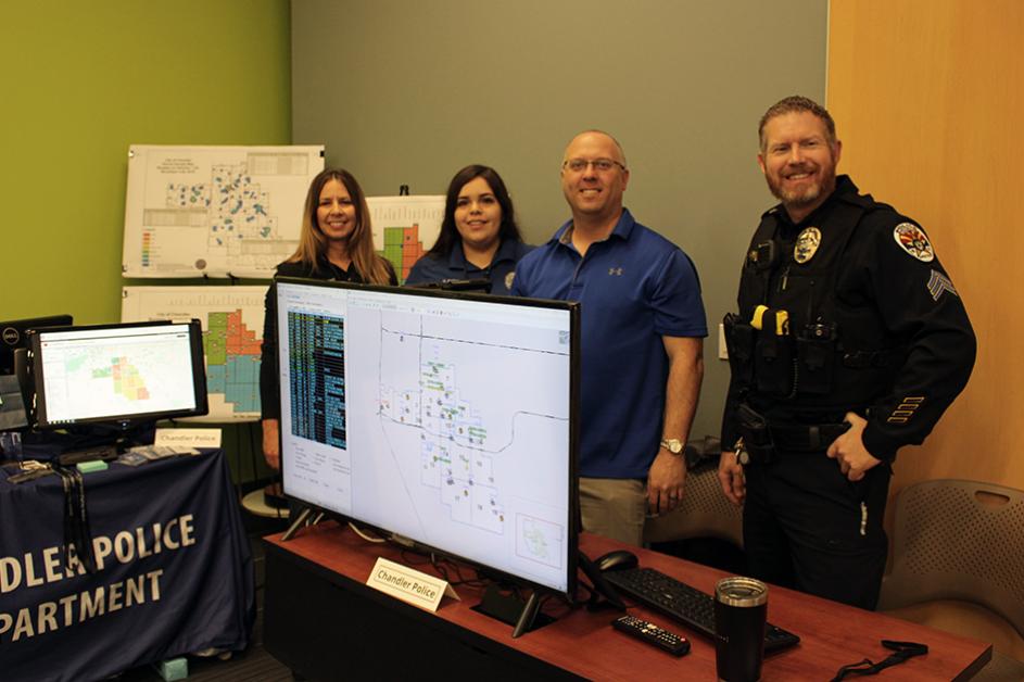
6. Public Safety maps help police and fire get to residents quickly
Chandler’s Police and Fire Departments use GIS technology to keep track of vital day-to-day operations. Maps displayed in police and fire vehicles show real-time locations of officers and firefighters on duty and give dispatchers information about the whereabouts of incidents and public safety personnel.
Externally, Chandler’s Community Crime Map is a public resource that shows a running list of crime incidents reported around Chandler and beyond. Residents are free to browse the interactive map to stay better informed about crime incidents in their areas.
7. Planning and Zoning maps help developers and residents know what’s coming next
Have you ever driven by a plot of land and wondered, “What are they building there?” Next time that happens, try searching the parcel on the City’s Interactive Planning Map. This popular feature allows you to search for zoning cases, see developer documents and get information on upcoming hearings and meetings related to development projects.
8. Chandler’s traffic restrictions map integrates with Waze
Save time and energy by checking up on your local routes before a trip to avoid unexpected restrictions using Chandler’s interactive Traffic Restrictions Map. Don’t have time to check the map? The real-time feed is integrated with the GPS traffic app Waze to help you make it to your destination with the most accurate traffic information possible.
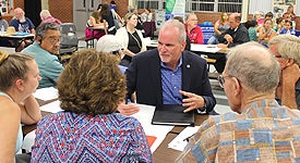
9. The City hosts an annual GIS Day to explore what to do next
As our way of celebrating National GIS Day, the City hosts a local GIS Day for City employees to internally share the latest and greatest applications of the technology. The event highlights projects, showcases GIS projects developed nationwide and serves as a time to brainstorm better ways to use GIS to serve Chandler residents.
10. GIS possibilities are endless
The tools named above are some of the GIS tools the City offers, and they are just the beginning of what is possible using this technology. Chandler is constantly exploring new possibilities for GIS use at the City level and brainstorming how to make GIS work better for residents and visitors of Chandler.


